Additional resources to help answer the most common Land Surveying questions
What Land Survey Companies Do – Beyond RPRs, Infill & Development Surveys
What Land Survey Companies Do – Beyond RPRs, Infill & Development Surveys Most people in Alberta only think about land surveyors when they need a Real Property Report (RPR) for buying or selling a home. But land surveyors do far [...]
Why Real Property Reports Matter: A Guide for Buyers and Sellers
When buying or selling a home in Calgary, few documents create more confusion, but also prevent more problems than the Real Property Reports (RPR). It’s one of the most essential pieces of information in any Alberta real estate transaction. Yet [...]
How to Read A Real Property Report (RPR)
Understanding how to interpret boundaries, structures, setbacks, and encroachments. A Real Property Report (RPR) is one of the most important documents in an Alberta real estate transaction. It establishes where buildings, fences, garages, and improvements sit in relation to the [...]
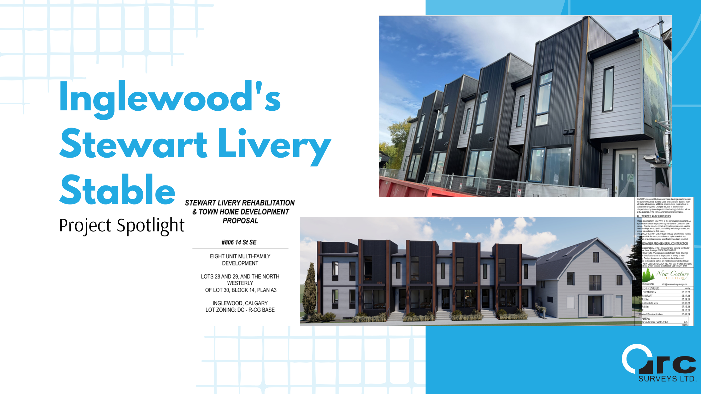
The Inglewood Livery and the Benefits of Infill Development in Calgary
From Heritage to Housing: The Inglewood Livery and the Benefits of Infill Development in Calgary Calgary is a city in constant motion. As our population grows, the way we design, approve, and build new homes must evolve to balance heritage, [...]
2025 Calgary Housing Strategy Update
In 2024, Calgary launched one of the most ambitious housing strategies in Canada. The six-year plan, called Home is Here, was designed to respond to an escalating housing crisis shaped by rapid population growth, rising home prices, and affordability challenges [...]
Lot Grading to Prevent Flooding in Calgary Homes
Why Lot Grading Matters: Preventing Flooding in Calgary Homes After the devastation of the 2013 flood, Calgary homeowners are no strangers to high waters, but the summer of 2025 has brought the issue into sharp focus once again. With more [...]
Do You Need an RPR to Sell Your Home in Alberta?
How to Tell if You Need a Real Property Report (RPR) Before Selling Your Home in Alberta If you're thinking about selling your home in Alberta, you’ve likely heard the term Real Property Report (RPR). But do you really need [...]
Property Line Surveys in Calgary Explained
Understanding Property Lines: Build Your Fence on the Right Side Have you ever looked at your fence and wondered, “Is this actually on the property line?” you’re not alone. Many homeowners make assumptions about where their land begins and ends, [...]
How Much Does a Real Property Report Cost in Alberta (and Is It Worth It)?
If you're preparing to buy, sell, or renovate a home, you’ve likely been told you need an RPR (Real Property Report) prepared by ab Alberta Land Surveyor. But how much does it cost, and is it really worth the expense? [...]
Planning a Renovation? Here’s Why You Might Need a New RPR First
Thinking of building a new garage, expanding your deck, or adding a garden suite? Before the hammer hits the nail, there’s one critical document you’ll likely need: an updated Real Property Report (RPR). Across Calgary and surrounding municipalities, zoning bylaws [...]
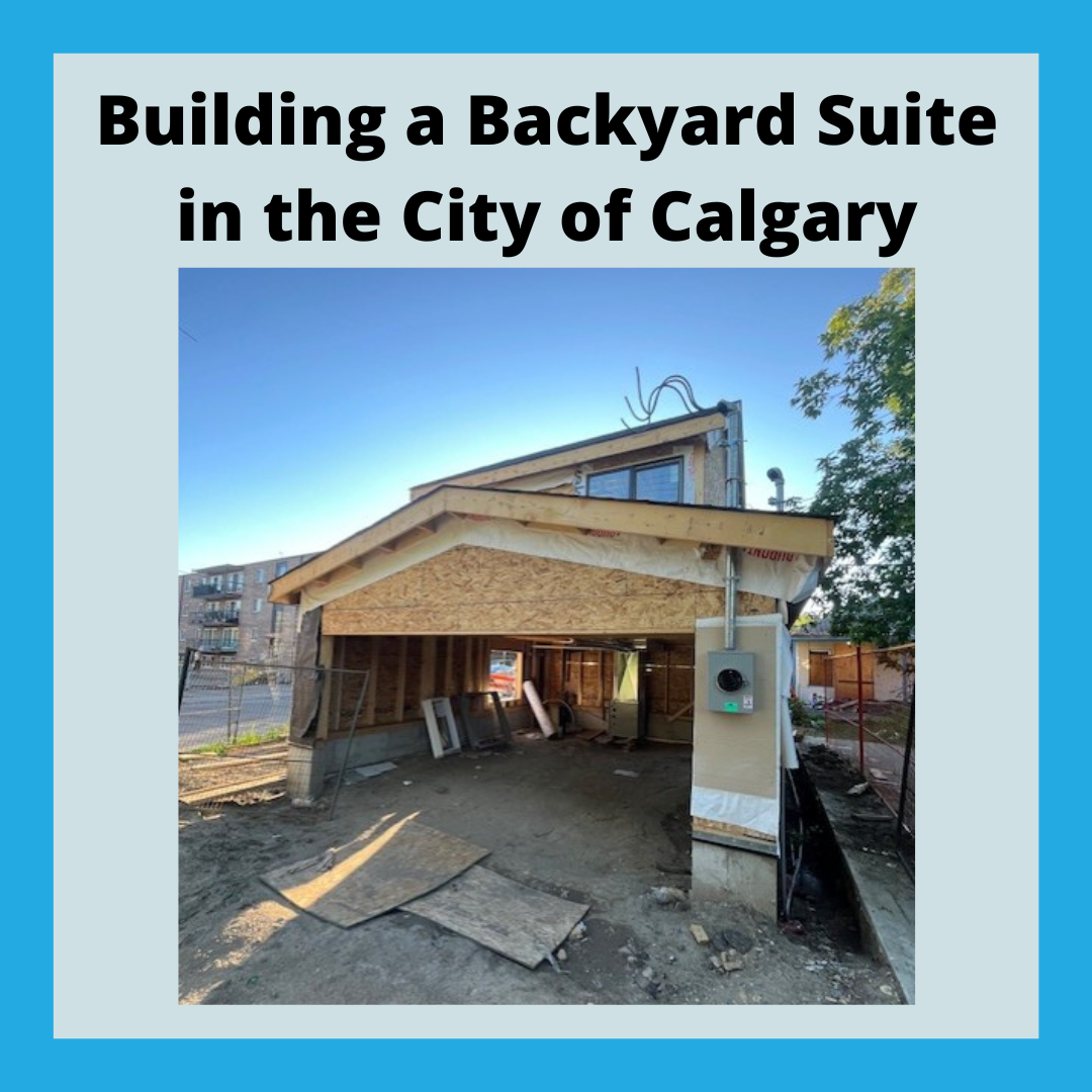
Step-by-Step Guide: How to Build a Legal Backyard Suite in Calgary
Including where you need a Real Property Report (RPR) to comply with bylaws and setbacks Building a backyard suite in Calgary is a smart way to invest in your property with an option for adding income to your bottom line. [...]
City of Calgary Compliance & Encroachment Process Explained
Some of the most common questions we receive about Land Surveying in Calgary is about the Compliance and Encroachments process. Non compliance and encroachment issues often are a cause of concern up to the last minute in real estate transactions, [...]
RPRs and Title Insurance: Why You May Need Both
In Alberta, a Real Property Report (RPR) prepared by a professional surveying company is required within the Real Estate contract for a seller to complete the sale of a house. Some may suggest that Title Insurance can be used instead [...]
Calgary Spring Construction Update 2025
As the spring sun warms the frozen winter ground and construction crews ramp up activity across Calgary, there’s no denying the momentum we’ve built together in recent years. In 2024 alone, the City processed a record 18,168 residential building permits, [...]
Calgary Survey Companies Role in Future Development
Calgary Survey Companies Role in Future Development As Calgary continues to grow and evolve, the role of survey companies becomes increasingly critical in shaping the city’s future. These firms provide essential services that ensure developments are planned accurately, efficiently, and [...]
Calgary Rezoning Bylaws and Development Permits
Calgary Rezoning Bylaws and Development Permits Calgary’s urban landscape is undergoing significant changes through rezoning efforts aimed at addressing housing demands and fostering sustainable development. Rezoning bylaws and development permits play a crucial role in shaping the city’s growth, influencing [...]
Key Benefits of Land Surveying in Calgary Infill Projects
Key Benefits of Land Surveying in Calgary Infill Projects Infill development projects, which focus on utilizing vacant or underused plots within existing urban areas, are becoming increasingly popular in Calgary. These projects aim to revitalize neighborhoods, reduce urban expansion, and [...]
How Calgary Rezoning Might Affect Land Surveyors
How Calgary Rezoning Might Affect Land Surveyors Calgary’s dynamic urban landscape is constantly evolving, and rezoning is a significant part of this transformation. Rezoning involves changing the designated use of land within the city, allowing for different types of development [...]
Drone Technology for As-Built Surveys
Drone Technology for As-Built Surveys In the ever-evolving field of construction and land surveying, accuracy and efficiency have always remained key components. As-built surveys are critical for verifying that projects have been completed according to design plans. Traditionally, these surveys [...]
The Efficiencies of Drones for Topographic Surveys
The Efficiencies of Drones for Topographic Surveys Topographic surveys are used for a variety of applications, from construction and land development to environmental management and archaeological research. Traditionally, these surveys were conducted using ground-based methods, which, although accurate, are often [...]

